Blank Map of Africa
All 54 African countries on one sheet, in four versions: blank, outline, numbered with an answer key, and labelled. Each comes as a PNG and as a PDF sized for US Letter.
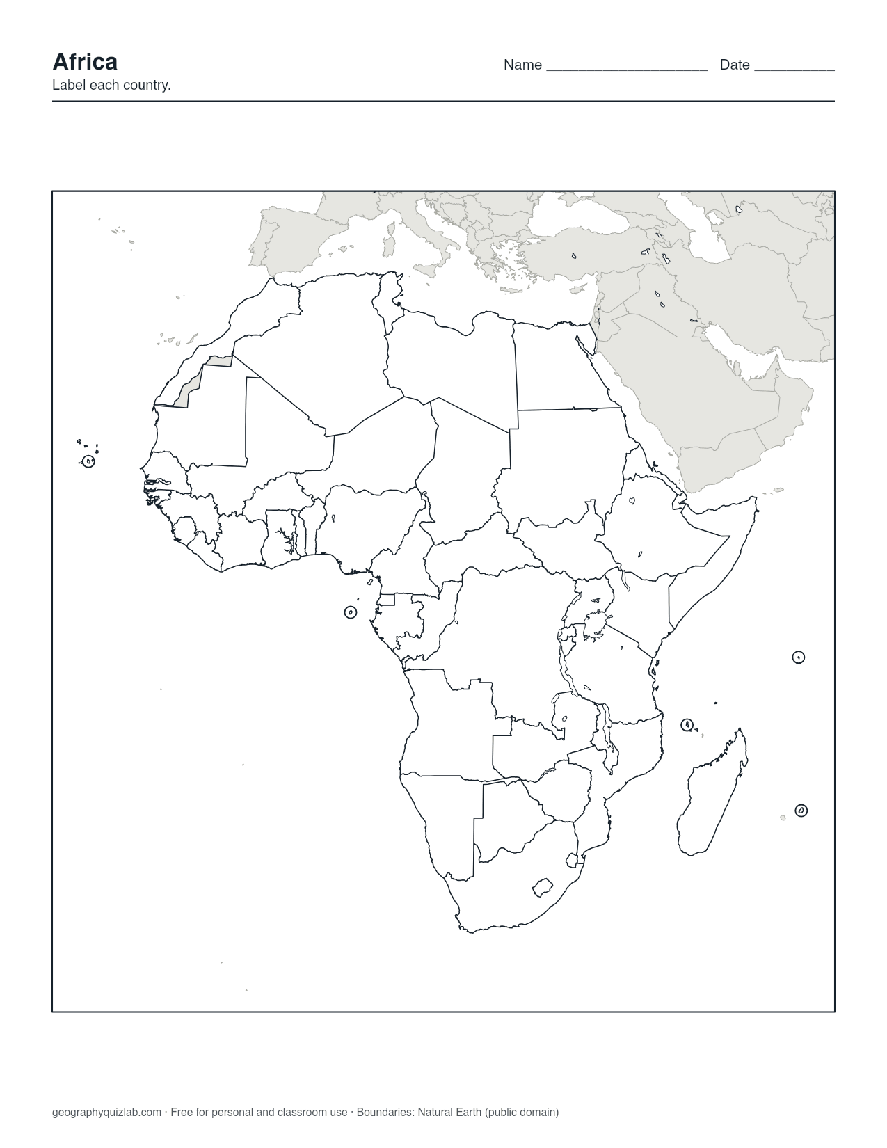
borders, no names
US Letter. Free for personal and classroom use (terms). Boundaries: Natural Earth (public domain).
Western Sahara is drawn as a separate shaded territory rather than as part of Morocco or as a country of its own, because sovereignty over it is unresolved. Our borders and names policy explains that choice. The five island nations, Cabo Verde, Comoros, Mauritius, São Tomé and Príncipe and Seychelles, are marked with rings so they do not vanish at this scale.
What each version is for
The Blank version has every border and no names, for labeling practice. The Outline version shows only the coast, so a student can draw the borders from memory or shade something that crosses them, such as the Sahara, the Nile basin or a climate zone. The Numbered version puts a number on each country and the answer key on page 2 of the PDF, ready for a test. The Labelled version names every country and works as the study and checking copy.
Where people go wrong on a blank Africa map
Fifty-four countries is the largest continent set, and a few spots cause most of the errors. Niger and Nigeria are neighbors: Niger is the large inland country to the north, Nigeria the coastal one to the south. There are three Guineas on the west coast: Guinea-Bissau the small one on the coast, Guinea wrapping around its south and east, and Equatorial Guinea much farther away on the Gulf of Guinea, beside Cameroon and Gabon.
The two Congos face each other across the Congo River. The Democratic Republic of the Congo is the huge one; the Republic of the Congo is its smaller western neighbor. Sudan and South Sudan sit one above the other, as the names suggest.
Three small countries are easier once you notice how they are enclosed. Lesotho sits entirely inside South Africa. Eswatini is nearly surrounded by South Africa, with Mozambique on its eastern side. Gambia is a thin strip along a river, with Senegal around it on three sides.
A study order
- North Africa first: Morocco, Algeria, Tunisia, Libya, Egypt. Big shapes along the Mediterranean.
- The southern block: South Africa, Namibia, Botswana, Zimbabwe, Mozambique, with Lesotho and Eswatini inside.
- East Africa and the Horn: Ethiopia, Somalia, Kenya, Tanzania, Uganda, then the smaller pieces such as Djibouti, Eritrea, Rwanda and Burundi.
- Central Africa around the two Congos.
- West Africa last, coast first, then the Sahel countries inland.
- The five island rings, which are quick to learn once you know which ocean each is in.
Printing and next steps
Africa is a little taller than it is wide, so the sheet prints upright. Choose "fit to page" if you are on A4. Gray context land and black borders photocopy cleanly.
Once the paper version is going well, try the Africa map quiz in Click mode, then the African countries quiz to name all 54 from memory. Boundaries are from Natural Earth (public domain), and the maps are free for personal and classroom use under our terms of use.