Blank World Map
A blank world map with all 195 countries: the 193 UN member states plus Vatican City and Palestine. Download it in four versions, each as a PNG and a US Letter PDF. Every version comes from the same drawing, so a student's numbered sheet and your labelled reference copy line up exactly.
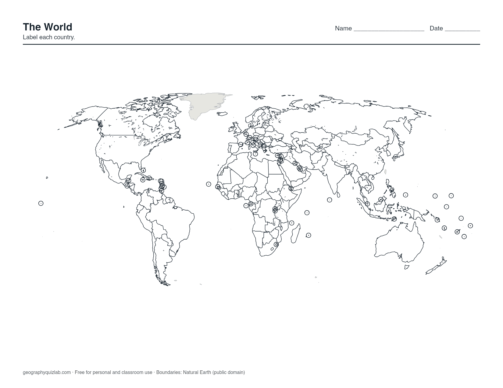
borders, no names
US Letter. Free for personal and classroom use (terms). Boundaries: Natural Earth (public domain).
Plenty of countries are too small to see at world scale, so each one gets a small ring. That covers the Caribbean and Pacific island nations, the European microstates such as Vatican City, Monaco and San Marino, and small mainland countries such as Gambia, Eswatini, Rwanda and El Salvador. A ring means "there is a country here", even when its land is only a speck.
Four versions, four jobs
Blank has every border and no names: the sheet for labeling practice. Outline keeps only coastlines, with no borders between countries, so you can draw the borders in from memory or shade patterns that cross them, such as climate zones, time zones or the route of an expedition.
Numbered puts a number on every country and prints the answer key on page 2 of the PDF. With 195 entries, it makes a better reference test for advanced students than a weekly quiz. Labelled names everything, with the smallest countries listed in a key, and works as a desk or wall reference.
How to learn the world from a blank map
Nobody labels 195 countries in one sitting. Start with the giants that anchor each continent (Russia, Canada, the United States, Brazil, China, India, Australia), then fill outward from them. Neighbors are easier to remember once you know what they border.
Next, take one continent per session. South America has only 12 countries and makes a good second step. Africa and Europe take longer, and their small states are where the rings matter most. Leave the Pacific and the eastern Caribbean for last: their rings sit close together and need a slow, deliberate pass.
After each session, check against the Labelled version and mark the misses. The world map quiz uses the same map in Click mode, and the countries of the world quiz asks you to type all 195 from memory.
What the map shows and leaves out
The world sheet uses a compromise projection, so Greenland does not balloon to the size of Africa the way it does on a Mercator wall map. The map is centered on Europe and Africa, which means the Pacific is split between the left and right edges.
Taiwan, Kosovo, Western Sahara, Greenland and Puerto Rico are not among the 195. The borders and names policy explains where every line and name comes from. Boundaries are from Natural Earth, which is public domain.
Printing and use
The world is about twice as wide as it is tall, so print the PNG with the page turned sideways. The PDF is set up for US Letter; on A4, choose "fit to page". Gray context land and thin black borders copy well on a school photocopier.
In class, pair the blank sheet with the countries and capitals list: label a continent, then add a dot for each capital. The maps are free for personal and classroom use under our terms of use.