Blank US Map
This blank US map shows all 50 states with their borders and no names. The same sheet comes in four versions, each as a PNG and a US Letter PDF, so you can print a practice copy, a test copy with an answer key and a reference copy that all match line for line.
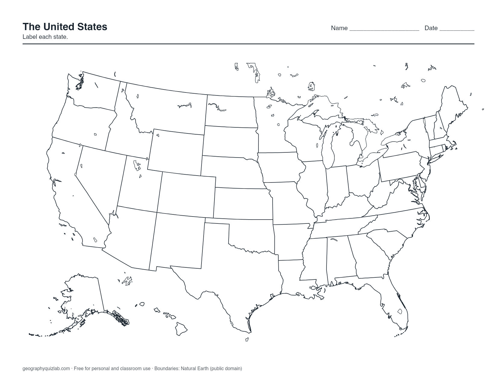
borders, no names
US Letter. Free for personal and classroom use (terms). Boundaries: Natural Earth (public domain).
One thing to know before you print: Alaska and Hawaii sit in boxes in the lower left, the way most US maps draw them. Those insets are not to scale or in their true positions. Alaska is far larger than its box suggests, and Hawaii is much farther out in the Pacific.
Which version to print
- Blank: state borders, no names. The standard sheet for labeling practice: write in every state you know, then fill the gaps from the labelled copy.
- Outline: only the coastline and the outer border of the country, no state lines. Use it to draw the states from memory, or as a clean silhouette for shading things that ignore state lines, such as climate zones or a river basin.
- Numbered: a number on every state, with the answer key on page 2 of the PDF. Hand out page 1 as a quiz and keep page 2. The numbers run from the top of the map downward, so the key reads roughly north to south.
- Labelled: every state named. Pin it up as a study reference or use it to mark answers on someone else's sheet. Where a name will not fit, it goes in a key.
Learning the states on paper
Fifty shapes at once is a lot, so work in blocks. The big western rectangles are the easy wins: Colorado and Wyoming are both near-perfect boxes, and Utah is a box with a notch cut out of its northeast corner. Next, find the Four Corners, the one point where Utah, Colorado, Arizona and New Mexico all meet.
New England is where most blank maps come back half finished. Vermont and New Hampshire are mirror-image wedges: Vermont is wider at the top, New Hampshire wider at the bottom. Rhode Island and Connecticut sit under Massachusetts, with Rhode Island the smaller one on the right. Down the coast, Delaware and Maryland share the Delmarva Peninsula with a strip of Virginia.
A good routine: label from memory in pencil, check against the Labelled version, then circle every state you missed. Next time, label the circled ones first. When the paper version feels easy, the US map quiz asks the same 50 states in Click mode, and the 50 states quiz asks you to type them all from memory.
Classroom and self-study uses
Teachers use the blank sheet for more than labeling. Color the four Census regions (Northeast, Midwest, South, West) in different shades. Mark each capital with a dot and write its name beside it. Trace a road trip, a river such as the Mississippi, or every state you have visited. For a full worksheet with numbered answer lines, see the US map worksheet.
Washington, D.C. is a federal district, not a state, so it is not one of the 50 the sheet is built around.
Printing tips
The PDF is already laid out for US Letter. If your printer uses A4, choose "fit to page" in the print dialog so the edges are not trimmed. The US is wider than it is tall, so if you print the PNG, turn the page sideways to get the largest map.
Every version is black and white friendly. Land that is not part of the quiz, such as Canada and Mexico, is shaded light gray and prints cleanly on a mono laser printer. Borders come from Natural Earth, which is public domain. The maps are free for personal and classroom use; the terms of use cover the details.