Blank Map of Europe
This blank map of Europe covers 49 countries: the 44 the UN counts as European, including Vatican City, plus Cyprus, Türkiye, Georgia, Armenia and Azerbaijan, which span Europe and Asia. Kosovo is an optional extra in the quizzes.
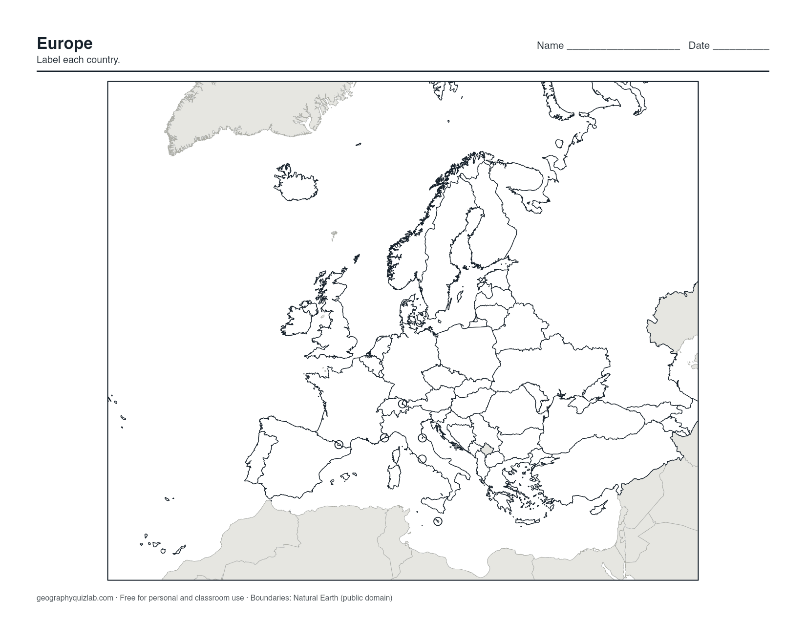
borders, no names
US Letter. Free for personal and classroom use (terms). Boundaries: Natural Earth (public domain).
Six of those countries are too small to draw at this scale: Andorra, Liechtenstein, Malta, Monaco, San Marino and Vatican City. Each is marked with a ring, so a student can still point to it and write a name beside it.
Pick the right sheet
- Blank: borders, no names, for labeling practice.
- Outline: the coastline and the outer edge of the region only. Use it to draw borders from memory, which is a hard but useful exercise for the Balkans, or as a base for shading river basins, language families or a rail trip.
- Numbered: a number on each country, with the answer key on page 2 of the PDF. This is the one to hand out as a test.
- Labelled: names on the map, with the microstates listed in a key. Use it for study and for checking answers.
An order that works for Europe
Start with the shapes people already know: Italy's boot, the Iberian Peninsula split between Spain and Portugal, and the Scandinavian peninsula with Norway down the west side and Sweden on the east. Add France, Germany, Poland and Ukraine as the big blocks in the middle, then the United Kingdom, Ireland and Iceland out to the west.
The Baltic states run Estonia, Latvia, Lithuania from north to south, which is also alphabetical. Slovakia and Slovenia are the classic mix-up: Slovakia sits north of Hungary, while Slovenia is the small one tucked between Italy, Austria, Hungary and Croatia. Leave the Balkans for a session of their own, working from Croatia's curved coastline inland to Bosnia and Herzegovina, Serbia, Montenegro, Albania and North Macedonia.
Finish with the microstates. Each ring sits inside or beside a bigger neighbor: San Marino and Vatican City inside Italy, Andorra between France and Spain, Liechtenstein between Switzerland and Austria, Monaco on the French coast and Malta south of Sicily.
Using the map in class
Label from memory, check against the Labelled sheet, then mark capitals with a dot. Shading the countries that use the euro, or drawing in the Danube and the Rhine, turns a labeling sheet into a discussion. For a ready-made version with numbered answer lines, use the Europe map worksheet.
When the paper map feels comfortable, move to the Europe map quiz in Click mode, then the European countries quiz, which asks for all 49 from memory.
Printing
The PDF fits US Letter; on A4, choose "fit to page". The Europe map is slightly wider than tall, so the PNG prints best with the page turned sideways. Russia continues off the eastern edge, and land outside the set is light gray, which keeps the sheet readable in black and white.
Boundaries come from Natural Earth (public domain). The map is free for personal and classroom use; see the terms of use.